Antioch Bridge, Antioch, CA: Location, Length, Height, Toll, History & Facts
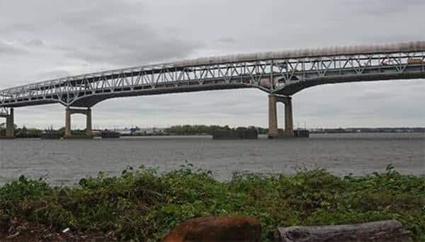
Antioch Bridge is the quietest of the Bay Area’s toll bridges, and it’s the only one that reaches beyond the nine-county Bay Area. From Antioch in northeastern Contra Costa County, the steel bridge arches high over the San Joaquin River and touches down on Sherman Island in Sacramento County, the gateway to the California Delta. Officially named the Senator John A. Nejedly Bridge, it opened in December 1978. It carries State Route 160 for 1.8 miles, with just one lane in each direction, and it’s open to walkers and cyclists. Drivers pay only heading north: $8.50 in 2026.

Antioch Bridge Key Facts
| Detail | Information |
| Official name | Senator John A. Nejedly Bridge |
| Location | San Joaquin River, between Antioch (Contra Costa County) and Sherman Island (Sacramento County), California |
| Coordinates | Approx. 38.0230° N, 121.7520° W |
| Highway | State Route 160 |
| Operators | Caltrans and the Bay Area Toll Authority |
| Bridge type | Steel plate girder bridge |
| Original bridge | Vertical lift bridge, opened January 1, 1926 |
| Original cost | About $2 million |
| Current bridge opened | December 1978 |
| Current bridge cost | About $34 million |
| Total length | About 9,504 ft (1.8 miles) |
| Channel span | About 460 ft |
| Vertical clearance | About 135 ft |
| Lanes | 2 (one in each direction) |
| Bicycles and pedestrians | Allowed |
| Seismic retrofit | 2013 |
| Toll direction | Northbound only (collected in Antioch) |
| Car toll (2026) | $8.50 |
| Carpool toll | $4.25 (FasTrak only, weekday rush hours) |
| Payment | All-electronic (no cash) |
| Annual toll-paid vehicles | About 3.2 million (FY 2022–23), the fewest of the Bay Area’s toll bridges |
| Time zone | Pacific Time: UTC−8 (PST), UTC−7 (PDT, second Sunday in March to first Sunday in November) |
Gateway to the California Delta
The Antioch Bridge crosses the San Joaquin River, which serves here as the Stockton Deep Water Ship Channel, the route large ships take inland to the Port of Stockton. On the south side, it begins in Antioch, one of the oldest towns in Contra Costa County, near the junction of State Routes 160 and 4. On the north side, it lands on Sherman Island in Sacramento County.
From there, State Route 160 winds north through the Sacramento–San Joaquin River Delta, a vast maze of islands, levees, sloughs and farmland, toward Rio Vista, Isleton and Sacramento. For many drivers, the Antioch Bridge is the start of one of Northern California’s most scenic back-road routes.
A High Bridge Built for Ships
The current Antioch Bridge was built high enough that ships never have to stop road traffic:
- It’s about 9,504 feet long, or 1.8 miles.
- Its main channel span is about 460 feet.
- It gives ships about 135 feet of vertical clearance.
- It’s a steel plate girder bridge, with the roadway resting on long steel beams.
- It carries one lane of traffic in each direction, unlike most of the Bay Area’s other toll bridges.
From the top, travelers get sweeping views of the Delta, Mount Diablo to the south and, on clear days, the Sierra Nevada foothills far to the east.
Paying the Toll
Tolls are collected only from northbound drivers, heading toward Sacramento County, at the toll plaza on the Antioch side. The southbound trip is free. The bridge is fully cashless.
| Payment method | Car toll (2026) |
| FasTrak | $8.50 |
| License plate account, one-time payment or invoice | $8.50 |
| Carpool (3+ people, FasTrak Flex) | $4.25 |
Tips for drivers:
- The carpool discount applies on weekdays during morning and evening rush hours for vehicles with three or more people using a FasTrak Flex tag set to “3+.”
- Tolls on the Bay Area’s state-owned bridges are scheduled to rise each year through 2030.
- With just one lane in each direction, plan for slower traffic behind trucks and RVs, especially on summer weekends heading to the Delta.
Walking and Biking the Bridge
The Antioch Bridge is one of the Bay Area state-owned toll bridges open to cyclists and pedestrians, and there’s no charge to cross.
- The climb to the top is long and steady, so cyclists should be ready for a workout.
- Winds off the Delta can be strong, especially in the afternoon.
- The views over the river, islands and farmland are some of the best in the region.
- The bridge connects with quiet Delta roads popular with recreational cyclists.
The 1926 Lift Bridge
The first Antioch Bridge was built by the American Toll Bridge Company and opened on January 1, 1926, at a cost of about $2 million. It was a link on the Victory Highway, an early coast-to-coast route across the United States. The bridge had two 270-foot spans and a lift section that could be raised to give ships 70 feet of clearance.
The State of California bought the bridge in 1940, and in 1945 the tolls were removed, making it a free crossing for more than 30 years.
Building the 1978 Bridge
As ship traffic to the Port of Stockton grew larger, the old lift bridge became too low and slow for both ships and cars. The state built a new high-level bridge that ships could pass beneath without stopping traffic. The new bridge cost about $34 million and opened in December 1978.
When the new bridge opened, tolls returned at 50 cents per car, collected northbound only. The bridge was named the Senator John A. Nejedly Bridge, honoring the state senator from Contra Costa County who championed its construction.
In 2013, Caltrans and the Bay Area Toll Authority completed a seismic retrofit to help the bridge withstand a major earthquake.
Things to Do Nearby
- Sherman Island, at the bridge’s north end, is famous for windsurfing and kiteboarding thanks to the Delta’s steady winds.
- Brannan Island State Recreation Area, a short drive north on SR 160, offers boating, fishing, camping and picnicking.
- Antioch’s historic Rivertown district has waterfront parks, a marina and local restaurants.
- Black Diamond Mines Regional Preserve, south of Antioch, has hiking trails and tours of historic coal and sand mines.
- The Delta Loop and Rio Vista offer marinas, riverside dining and scenic drives along the levees.
FAQs
Q1. How much is the Antioch Bridge toll in 2026?
A. The toll is $8.50 for cars, collected only on northbound trips. Carpools pay $4.25 during weekday rush hours.
Q2. Is the Antioch Bridge toll charged both ways?
A. No. Tolls are collected only northbound, at the toll plaza on the Antioch side.
Q3. Does the Antioch Bridge accept cash?
A. No. Tolls are fully electronic, by FasTrak, license plate account, one-time payment or invoice.
Q4. How long is the Antioch Bridge?
A. It’s about 9,504 feet long, or 1.8 miles.
Q5. How high is the Antioch Bridge?
A. It gives ships about 135 feet of vertical clearance over the San Joaquin River.
Q6. When did the Antioch Bridge open?
A. The current bridge opened in December 1978. The original lift bridge opened on January 1, 1926.
Q7. What is the official name of the Antioch Bridge?
A. It’s officially the Senator John A. Nejedly Bridge.
Q8. Can you walk or bike across the Antioch Bridge?
A. Yes. The bridge is open to bicycles and pedestrians.
Q9. What does the Antioch Bridge connect?
A. It connects Antioch in Contra Costa County with Sherman Island in Sacramento County, carrying State Route 160.
Q10. How many lanes does the Antioch Bridge have?
A. It has two lanes, one in each direction.







Post Comment